Video: Exclusive tour of the upper Pilarcitos Creek watershed

 border=
Leonard Woren
 border=
Leonard Woren
 border=
Click to download a large map of the watershed.

By on Thu, May 10, 2007

Here is an opportunity to see a large piece of San Mateo County—just over the hill from the Coastside—that the public rarely gets to see.

Monday, the Pilarcitos Creek Restoration Workgroup took a tour of the upper Pilarcitos watershed on San Francisco Public Utilities Commission land. The land was purchased in the late 1800s by the Spring Valley Water Company to provide water for the city of San Francisco. This watershed is now the source for a significant portion of Coastside County Water District’s (CCWD) water.  

To protect the quality of this water, almost all of the watershed is closed to the public.  Only workgroup participants could be accommodated on this tour.  At the end of the tour, the business meeting took place, and is not included in the video although a bit of it is audible as I did a 360° shot of the outdoor meeting location, and then a quick pan of the participants.

The workgroup includes many organizations with an interest in Pilarcitos Creek and the watershed.  According to its memorandum of understanding (MOU) , the purpose of the workgroup is

to work as partners to balance all of the beneficial uses of available water resources in the Pilarcitos Creek watershed and to find solutions that protect the environment, agriculture, public health, domestic water supply, and economic interests.

I was able to take a video camera on the tour, to allow others to see the beauty of this closed watershed.  This video was all shot hand-held, so some of it is a bit jumpy, but I think it’s worth it.  

This was a rare hot sunny day in the watershed—we were lucky, because often when people are escorted up there, they complain that they can’t see anything through the fog.

Google Maps has an excellent satellite photo of Pilarcitos Reservoir. You can zoom in to see some of the structures in the video, and you can zoom out to see where it sits relative to the Coastside.

EDITOR’S NOTE: We’ve taken down the videos at Leonard Woren’s request, because of a request to Leonard from the San Francisco Public Utilities Commission.

Darin’s Monday Photo: Erosion

 border=
Darin Boville
Coastsider presents a weekly publication-quality photo of the Coastside. Our goal is to provide the community with photos they can reuse as as desktop backgrounds, screen savers, cards, or to print for display. Click to download full-size version (2.1 mb). Copyright © 2007 by Darin Boville. FREE for personal use.

By on Wed, May 9, 2007

A free Monday photo on a Wednesday! Sorry for the delay—I was in Yosemite without Internet access.

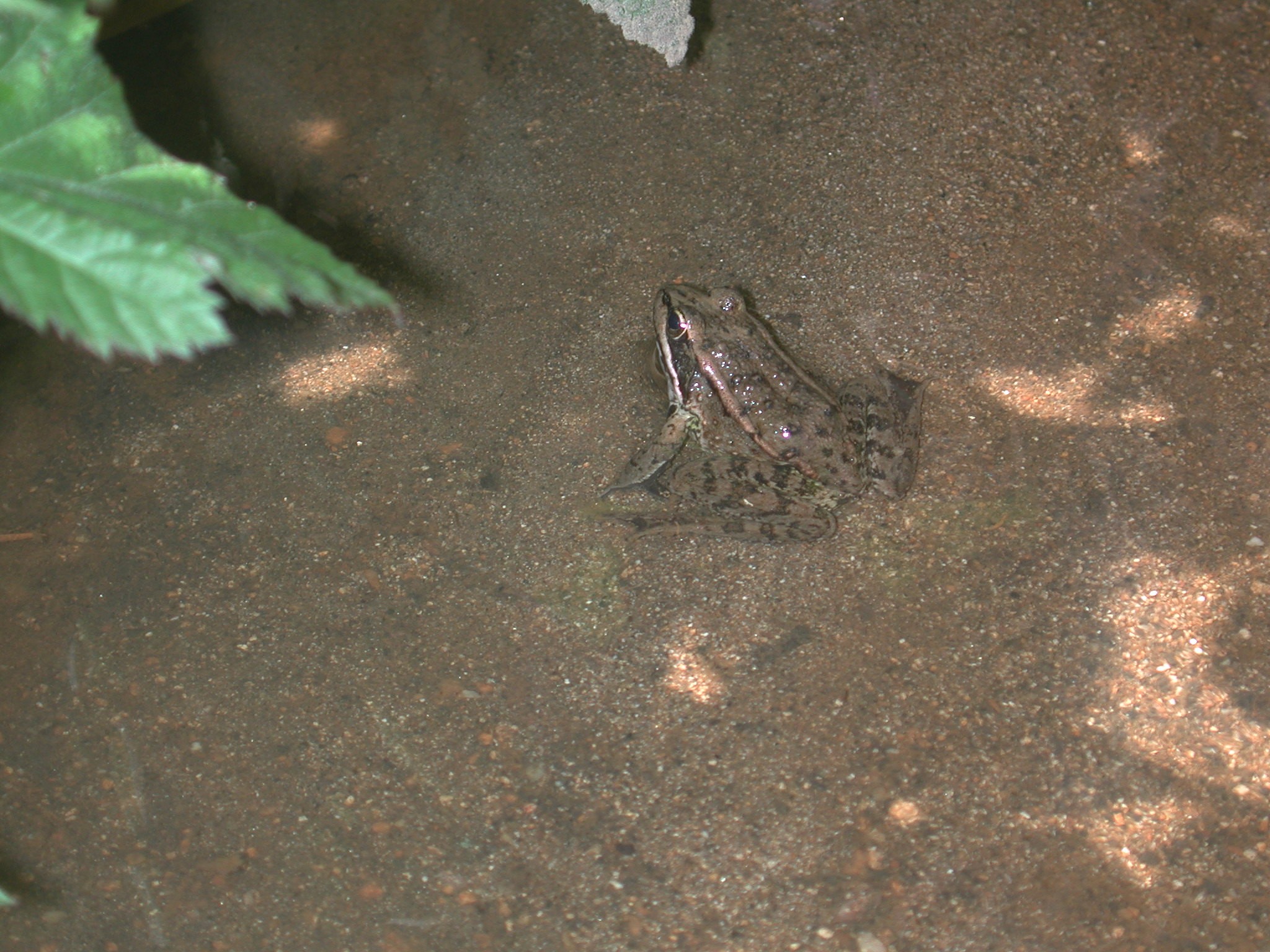
Photos: California red-legged frog in Montara

 border=
Chuck Kozak
Chuck Kozak encountered this most accommodating California red-legged frog -- slightly smaller than medium sized -- on Saturday in Montara Creek during the "Snapshot day" water quality sampling.
 border=
Chuck Kozak
 border=
Chuck Kozak

By on Sun, May 6, 2007

Tour Montara wetlands restoration with Audubon Society, Tuesday May 15

 border=
Caltrans is restoring these wetlands in Montara, across the street from the old Charthouse, to mitigate some wetlands lost in building the Devil's Slide tunnel.

By on Fri, May 4, 2007

The Sequoia Audubon Society is hosting a field trip to the Caltrans Devil’s Slide Charthouse Wetlands Mitigation Project on Tuesday, May 15, at 11:15 am.  The public is invited. 

Meet at the parking lot adjacent to the former Charthouse restaurant in Montara.  Caltrans wildlife biologist, Jason Minton, will discuss the project and be available to answer questions.  The field trip will be followed by a short bird walk.  Bring your binoculars!  For more information contact Bill Bechtell, 728-3946, or [email protected].

Darin’s Monday Photo: Boat washed ashore

 border=
Darin Boville
Coastsider presents a weekly publication-quality photo of the Coastside. Our goal is to provide the community with photos they can reuse as as desktop backgrounds, screen savers, cards, or to print for display. Click to download full-size version (2.2 mb). Copyright © 2007 by Darin Boville. FREE for personal use.

By on Mon, April 30, 2007

Darin’s Monday Photo: Driftwood

 border=
Darin Boville
Coastsider presents a weekly publication-quality photo of the Coastside. Our goal is to provide the community with photos they can reuse as as desktop backgrounds, screen savers, cards, or to print for display. Click to download full-size version (5.3 mb). Copyright © 2007 by Darin Boville. FREE for personal use.

By on Mon, April 23, 2007

Researchers map seafloor at Mavericks

 border=
NOAA
Nearshore reef in the vicinity of the San Gregorio fault. The 3-D image is color-coded by depth: the blue and green areas are deeper than the areas in yellow and red. As a wave front approaches the shoreline and progressively enters shallow water, it becomes compressed and grows taller.
Updated

By on Thu, April 19, 2007

Researchers have created a map of Mavericks as part of a project to map the sea floor off the central California coast.

The newly collected data shows that the wave-making setup at Mavericks involves a portion of a rocky reef that protrudes above its surroundings while remaining under water. As a wave approaches the shore and enters shallower water, it compresses and grows taller. A ridge promontory also focuses wave energy and the wave rapidly increases in height, creating a monster.

At the highest point of the protrusion, the wave becomes unstable and breaks. Data collection was impossible in that location because the rough sea presented too much danger to the scientists.

UPDATE: The mapping project’s site has a lot more maps and charts.


Darin’s Monday Photo: Bench along Coastal Trail

 border=
Darin Boville
Coastsider presents a weekly publication-quality photo of the Coastside. Our goal is to provide the community with photos they can reuse as as desktop backgrounds, screen savers, cards, or to print for display. Click to download full-size version (2.5 mb). Copyright © 2007 by Darin Boville. FREE for personal use.

By on Mon, April 16, 2007

Photos: Step It Up 2007 at Montara Beach


By on Sun, April 15, 2007

Despite a day that began with a drenching downpour, Step It Up managed to get good turnout Saturday for a picnic and an organized shoot from the air of participants lined up at what might be the new shoreline if global warming continues.

 border=
Kevin Stokes
 border=
Kevin Stokes
 border=
Kevin Stokes

Darin’s Monday Photo: Seagulls on the beach

 border=
Darin Boville
Coastsider presents a weekly publication-quality photo of the Coastside. Our goal is to provide the community with photos they can reuse as as desktop backgrounds, screen savers, cards, or to print for display. Click to download full-size version (2.0 mb). Copyright © 2007 by Darin Boville. FREE for personal use.

By on Mon, April 9, 2007

Page 56 of 79 pages ‹ First  < 54 55 56 57 58 >  Last ›