Coastal Commission approves Ritz riprap consent decree


By on Thu, July 14, 2005

The California Coastal approved a consent decree between the commission and Ocean Colony Partners "to address removal of unpermitted rocks riprap below 18th hole of Half Moon Bay Golf Links".  The seawall has been a source of contention between the resort and public access advocates ever since it was erected.

Nunez appoints Chula Vista mayor, re-appoints Monterey’s Potter to Coastal Commission


By on Thu, July 14, 2005

Assembly Speaker Fabian Nuñez has re-appointed Monterey County Supervisor Dave Potter to the California Coastal Commission, and appointed Chula Vista Mayor Steve Padilla.

The Sierra Club organized a campaign against Potter, reports the Monterey County Herald.

"I’ve been reappointed more than anybody in Coastal Commission history," he said. But he said this particular round was a "challenge" because of opposition from some environmentalists.

As supervisor, his vote in favor of a Pebble Beach Co. plan that includes cutting down part of the Del Monte Forest has been unpopular with some conservation groups, especially the Sierra Club.

"That’s the trouble with making decisions," he said. "They’re not always popular."

Padilla spearheaded a huge waterfront plan for Chula Vista—a plan which will go before the Commission, according to the San Diego Union Tribune.

Padilla, who was elected mayor in 2002, said he was approached by people in the labor and environmental community about the commission seat.
...
Bruce Reznik, executive director of San Diego Baykeeper, said his environmental organization supported Padilla. The group was impressed with Padilla’s political savvy in winning support from different groups as he worked to develop the city’s bay front.

"I really think he’ll be an environmental leader," Reznik said. "Right now, this is a really critical seat."


Did a developer steal this woman’s camera?

 border=
Cheri Parr
Barbara Mauz is ankle-deep in eucalyptus cuttings, and shorter than this pile of chips.
 border=
Victoria Ortiz
It may be ephemeral, but the stream and the surrounding trees dwarf Barbara Mauz and Coastsider photographer Cheri Parr.
 border=
Cheri Parr
A little further downstream, you can see tracks where the bed is being used as a road.
 border=
Cheri Parr
The wood chips drift like snow among the trees. Yesterday, they were trees.
 border=
Cheri Parr

By on Wed, July 13, 2005

On Monday morning, says Barbara Mauz, men clearing land for a Miramar developer stole her camera while she was trying to take a picture of what they were doing.

Barb Mauz lives on the southern edge of El Granada, within earshot of Miramar. Recently, that area of Miramar has become a center for development in the unincorporated Midcoast.

The area is sensitive. It butts up against the urban/rural boundary and the Mirada Surf hillside area. It’s on the borders of three greenbelt open space areas:  Mirada Surf, Quarry Park and Peninsula Open Space Trust’s Wicklow property.

An ephemeral stream (a stream that flows only during and after it rains) winds through it. Although the stream is ephemeral and partially underground, you can see a well-defined channel and the willows, riparian plants that thrive on stream banks.  You can see the willows further downstream at the Quarry Park access road of Highway 1. It passes under the highway to feed the willows at Magellan as well.

Welcome to Miramar Heights

In the last few years, an entire neighborhood of mansions has sprung up almost overnight in Miramar east of Highway 1. Someday, they’ll call it Miramar Heights, but you probably don’t even know it’s there, because most of this development is just out of sight of the highway.

But as the development has moved east toward the hills, and north toward El Granada, it has become impossible for folks in this part of El Granada to ignore.

Barb Mauz has several concerns. First, they were filling the stream bed with wood and chips from the eucalyptus trees they had cut down. Second, in addition to blocking the stream, the eucalyptus could be lethal to plants and animals in its bed.  Third, she wants to make certain that whatever changes are being made are recorded, so that Coastsiders and the county understand what is lost in this development. And she wants to make sure that the urban/rural boundary and greenbelt open space areas are respected.

What Barb saw

Barbara Mauz is a small woman, but she’s also a fierce defender of her local environment. She’s fought many battles over the years with developers, the county, and the Coastal Commission.

She knew the development had been going on, but she wasn’t necessarily expecting anything Monday morning. She described what happened in an email.

I heard lots of saws and noise & when I went up from our house and looked down Moro to where my little stream is. All of the trees there were gone. So, I went over there with my little throw-away camera to document whatever was going on. I took a picture of some guy blowing Eucalyptus chips into the channel—those chips can kill any wetland plants and animals. The guy in charge came over and asked me what I was doing. I told him I was concerned about the stream and the area in general as it is a fragile and beautiful place directly adjacent to the Open Space areas.

I told this guy and the one in charge that it would be just plain terrible for people who walk past this area going up to quarry park & will now only see monster houses instead of the natural area. He appeared to be listening and said that he didn’t want people taking pictures of his truck and that he didn’t want anyone from the county coming over looking at what they were doing—then he snatched my camera; he gave me a $20 bill. I told him that I didn’t want his money and that I wanted my camera back.

But Barb wasn’t getting her camera coming back.

On Tuesday, my wife Cheri went to the site with Barbara Mauz to take more pictures. Our daughter and her friend tagged along.  The guys got into their truck and left the site at the sight of the two women and two girls armed with yet another camera.

Wednesday, Barbara Mauz filed a report with the Sheriff’s office. The deputy who took the report went over to the site, but the man whom Barb says took her camera denies having done it.

What are we to do?

Babara Mauz wants the stream protected. Right now, it isn’t recognized as a coastal resource by the Coastal Commission. She says, "Make the county and the owners restore the stream and plant sequoias for people who are using Quarry Park. Write letters asking the County Board of Supervisors not to permit building on this ephemeral stream—or other such streams & creeks such as Medio Creek which is also currently under threat"

Barb wants a movement.  The first step is to understand what’s happening in this place and to share that information.

We’ll never know what’s happening in out-of-the way neighborhoods unless we ask questions, take pictures, and share information. If we’re going to do this, we have to assert our right to know what’s happening. That’s a big reason I started Coastsider.

We only have Barbara Mauz’s word for what happened on Monday. But I do know that despite her fears for her safety and privacy, and her doubts about the Sheriff’s interest, she took her complaint to the Sheriff’s office.

I also know that I have been the subject of aggressive behavior at construction sites that I have photographed for Coastsider.

I am beginning to learn how quickly the landscape in this part of the Coastside has been altered. Everyone should be aware of this, because it doesn’t take long to completely change place this size.

With the county’s Local Coastal Program about to be updated, what’s happening in Miramar could happen anywhere. Large parts of Montara are already in play in the LCP update.

What is essential is that everyone on the Coastside know what they’re missing behind a thinning screen of trees, in a buried ephemeral stream bed, on the film in a stolen camera, or in a windowless room in Redwood City.

State agrees to make parks and beaches more accessible


By on Wed, July 13, 2005

The state Parks Department has agreed to make state parks and beaches more accessible to the disabled, settling a class-action lawsuit.

Completion could take eleven years and more than $100 million, according to the Chronicle. The state is already planning to make Half Moon Bay State Beach accessible by 2009 and San Gregorio State Beach by 2014. Popular state beaches could offer wheelchair access with rubber walkways on the sand or big-tired beach wheelchairs that work on sand.

Cypress Cove survey gives NIMBY a bad name


By on Wed, July 13, 2005

Coastsider has obtained a copy of the results of the Cypress Cove homeowners’ association survey its members. This data was reported to the Cypress Cove Townhome Association in mid-June.  Although the survey has been quoted by the Association’s attorney, to my knowledge no one else has seen it. Go to the links at the end of this story to download the results.

More than half of Cypress Cove’s 128 households responded. Even considering that the survey was biased against the park, it’s clear that Cypress Cove residents are unhappy. Only about half would support even a ten-acre "passive park" on the 22-acre site. And it’s downhill from there.

They’re scared of a park

NIMBY is a term that gets thrown around a lot these days.  When someone wants to put a refinery or a nuclear waste dump near your home, "Not in my back yard!" isn’t an unreasonable reaction.

But we’re talking about a park.  How do we explain their dissatisfaction?

Only 10% of the respondents have kids living at home.  Some respondents mentioned that they chose the community for this reason. And more than half of those responding say they don’t agree that anybody’s quality of life would be improved if kids have a place to play sports.

There is also the problem that Cypress Cove is laid out in a way that makes traffic and parking a constant irritant to its residents, with narrow streets and little parking for visitors.

So, perhaps Cypress Cove residents are predisposed to think of parks as sources of noise, traffic, chaos, dirt, litter, vandalism, accidents, trespassing, drinking, and drugs. More than half of them do, apparently.

Not everyone in Cypress Cove feels this way of course, and I’ve talked to people who live there that understand the park will be beneficial, not simply for the Coastside in general, but for Cypress Cove in particular. 12% of respondents volunteered comments that the survey was too expensive or biased and 8% said not to spend money on surveys.

But the neighborhood’s opposition to the park is remarkably uniform and hard to explain.

Is compromise impossible?

In addition the problem of listing mostly negative implications of the park, the survey was biased against compromise.

Respondents were given a choice between a "passive park" that would have "perhaps a hundred daily visitors" and a "sports and athletic complex" that would attract "perhaps a thousand daily visitors".  But no middle ground is offered between the two undefined uses and order of magnitude difference in visitors.

Respondents also were not given a lot of options for action. Two-thirds of the respondents agreed to the statement that the Homeowners Association "should be prepared to protest, perhaps to the point of going to court". However, they were presented with a stark yes/no choice.  If they were prepared to protest, they should be prepared to sue.

The survey suggests that Cypress Cove’s choices are to capitulate or fight.

See for yourself
You can download the survey results and draw your own conclusions. It’s available for download in full or in part.
  • The full report is a big file (38MB), so I’ve broken it into smaller pieces:
  • The summary has most of the information and charts you’ll need.
  • The detailed findings has more information and analysis.
  • The questionnaire is here if you need it and you probably will if you want to analyze the results yourself.
  • The tables, for survey geeks only, have several interesting crosstabs for each response, including breaking out each response by whether people are inclined to sue the city.

Why you should care about substandard lots

 border=
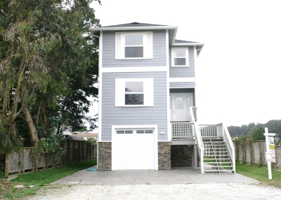
This El Granada house isn't much wider than its garage and is just about as wide as its narrow lot, with a walkway on either side.
 border=
This Miramar house and the one in the next picture are back-to-back on narrow lots.
 border=
Opinion

By on Mon, June 27, 2005

San Mateo County is proposing changes to its Local Coastal Plan (LCP) that could dramatically affect the quality of life in the unincorporated Coastside. By making it easier to build on substandard lots and by exempting more houses from its size requirements and annual growth limits, these changes could completely change the texture of our community.

What is a substandard lot, anyway?

One of the most important issues in the current revisions of the LCP’s for Half Moon Bay and the unincorporated Mid-Coast is how substandard lots are handled.

The size of a standard lot is set by zoning. In most areas of the Coastside, a standard lot is 5,000 square feet, usually 50 feet wide by 100 feet deep. Under long accepted Land Use Planning and Procedures Law, it’s easier to develop a standard lot than a substandard lot because less staff review, public hearings and board consideration is required when lots conform to current regulations.

Thousands of small lots (25 square feet wide) were created on the Coastside when larger units of land were “subdivided” a hundred years ago. Subdivision is not a public process. It’s done by land owners so they can sell their land to multiple buyers.

Subdivision alone creates no right to build anything. That requires a permit and public process. Subdivision does mean that the land owner has submitted a “subdivision map” to the governing land use agency and that the map was approved, allowing the subdivided pieces of land to be individually sold.

Ideally, the land use planned in the subdivision map is consistent with land use plans and zoning. But, over time, these can diverge.

Zoning says how those lots can be developed

Zoning is the set of physical rules and standards by which a General Plan’s vision is implemented.

Zoning regulates the type and intensity of land use, and should serve public goals by keeping compatible uses together and to separate incompatible uses. Zoning should be orderly, compatible and conducive to the public health, safety and welfare. For example, one might not want to put pork rendering plant next to homes or a rifle range next to a hospital.

For example, Half Moon Bay adjusts the size of a house to keep it in proportion with the site. For a 2,500 square foot lot in a 5,000 square foot zone, the result is an 800 square foot cottage instead of a 1,300 square foot starter house.

Since thousands of lots from the Coastside’s antiquated subdivisions are smaller than the minimum zoning requirement of 5,000 square feet, they are legally “substandard”. This does not mean unusable but rather “usable with care” so as not to harm the public interest by causing undue crowding, traffic congestion, demand for public services, pollution, environmental damage, crime, noise, etc.

Ninety percent of the substandard lots on the Coastside are located in the unincorporated Mid-coast, which is controlled by San Mateo County.

The county now requires only a “Use Permit” to develop on a substandard lot. This means a public hearing to determine if (1) the applicant has made a good-faith attempt to acquire adjacent land so as to make the building site standard and (2) the proposed development would not harm affected property owners or the public interest.

The county doesn’t enforce the good-faith requirement, and assumes no harm in the case of a single house. This ignores the long-term implications of a death by a thousand cuts. However, at least the “Use Permit” process puts the process out in the open, allowing public input and Coastal Commission appeal for egregious abuse of the public interest or precedent-setting cases.

What is the county proposing?

In its proposed changes to its LCP, the county proposes to make it even easier to develop substandard lots. The new LCP would make any substandard lot of 3,500 square feet or greater yet under the Zoning Lot Minimum Requirement of 5,000 square feet considered “buildable, as a matter of right” and only require a “Use Permit” for lots under 3,500 square feet. This would gut the central purpose of zoning and eliminate any possibility of public hearings and Coastal Commission appeals for thousands of future houses affecting current residents.

Moreover, the county is proposing to remove affordable housing and all housing on substandard lots from their annual Growth Control Limits. The county would also exempt development of substandard lots from any meaningful proportionality requirement. These are the very lots where proportionality rules are most needed.

The county’s new approach seems inconsistent with the Coastal Act, which clearly states that affordable housing is subject to the Coastal Act, just like any other development in the Coastal Zone.

What’s the alternative and what can you do?

Half Moon Bay’s approach to substandard lots is now part of its LCP and has been accepted by the Coastal Commission. Half Moon Bay’s Proportionality Rule has not been challenged in court by anyone, most likely because reasonable use of substandard lots is still allowed.

In contrast, the county is moving toward treating substandard lots as if they were standard. The coastal Commission already rejected this approach in 1998 during the county’s ill-fated Coastal Protection Initiative. It is highly debatable whether Mid-Coast residents would politically support the county’s approach if they knew about it. The time to speak up for an all inclusive Growth Control and Proportionality Policy is now as the next Board of Supervisors’ Public Hearing on the county’s LCP is set to take place in July. Send your written comments to the county Board of Supervisors asking that your comments be made a part of the Official county Record regarding the county’s LCP Update as follows:

President Richard Gordon and Members of the Board of Supervisors Hall of Justice and Records 400 county Center Redwood City, CA 94063

Fax a copy of your comments to George Bergman, Project Planner at Fax: 363-4849 and also to the California Coastal Commission c/o Chris Kern at Fax: (415) 904-5400.

State senate appoints Coastal Commissioner from Mahattan Beach

 border=
Steve Moses
Aldinger poses awkwardly in front of Manhattan Beach pier for a campaign photo.

By on Sat, June 25, 2005

On Wednesday, a state senate committee appointed Manhattan Beach city council member Jim Aldinger to the California Coastal Commission, reports the Daily Breeze. Aldinger will serve for four years, beginning with a meeting next month.

Aldinger says he considers coastal development and access and preservation of environmentally sensitive habitats among the most important issues facing the Coastal Commission. Commissioners, recently, have been leaning toward allowing rather than curbing coastal development, he said.

"I understand it’s hard for one person to get in and make quick changes," he said. "But I think it’s definitely possible to bring about a change, although it takes time and a lot of hard work."

State Supreme Court rules Coastal Commission is constitutional


By on Thu, June 23, 2005

The California state Supreme Court ruled unanimously that the Coastal Commission is constitutional. Two lower courts had said the Commission was unlawfully formed by the Legislature in 1976.

The Legislature had changed the terms of commissioners in 2003 to improve the Commission’s chances of being accepted bye the Supreme Court.  The court decided not to reopen earlier decisions decided under the earlier composition. The Court could have reopened 100,000 land-use decisions by the Commission.

A dozen Montara homes are evacuated after gas line is broken


By on Fri, June 10, 2005

A construction crew broke a gas line in Montara around 1pm Thursday, causing the evacuation of a dozen homes on the 500 block of Eighth Street.

The line was broken by a crew installing a water line. According to George Irving, manager of Montara Water and Sanitary District, the crew that broke the line was doing work for a private home and it was unrelated to the water line replacement that the District is doing in Montara.

Half Moon Bay golf course will remove controversial seawall

 border=
Copyright (C) 2002-2005 Kenneth & Gabrielle Adelman, California Coastal Records Project, www.Californiacoastline.org
This photo was taken in September 2002, before half the riprap was removed. It shows some of the problems with the seawall at the golf course. There is increased erosion on either side of the seawall. The high tide line comes up to the cliff and the boulders extend into the water, making it difficult and dangerous for the public to cross this part of the beach. Some boulders spend so much time in the water they're covered with moss. Click on the photo for a larger version if you need to see more detail.

By on Thu, June 9, 2005

Ocean Colony Partners has negotiated an agreement with the California Coastal Commission to remove a 270-foot seawall consisting of granite boulders (also known as "riprap"). The seawall is on the beach below the golf course’s 18th green.

According to Lisa Haage, chief of enforcement at the Coastal Commission, "This will still have to go the Commission. But work can’t begin until fall, so there will be plenty of time to plan the removal." Haage expects to have a written agreement before the Commission at its July meeting.

"I’m pleased to put this episode behind us," Bruce Russell of Ocean Colony Partners told me. "Now we can move on. It’s a much better situation."

Seawalls have many negative impacts, including increasing erosion of the beaches in front of them and of the cliffs on either side. Coastal activists have been fighting to get this one removed ever since it was put up without a Coastal Development Permit in 1998.

"During its lifetime, it was truly one of the worst seawalls in California," said the Sierra Club’s Mark Massara, "because it extended into the surf even at low tides and made lateral beach access a dangerous nightmare."

The company had fought to get the California Coastal Commission for years to keep the seawall.

In 2002, Ocean Colony Partners negotiated a consent agreement with the Coastal Commission and removed half the riprap in 2003 and 2004. OCP then applied to reinforce the remaining riprap. 

OCP’s application to reinforce the seawall was scheduled to be heard by the Coastal Commission in February, but OCP withdrew its application after Commission staff recommended denying it.

Coastal Commission staff opposed keeping the remaining seawall because there was an alternative—moving the 18th green. However, Ocean Colony Partners had been unwilling to move the green of its 18th hole because it is a "signature hole" on its golf course, which has been recognized as one of the top 100 golf holes in the US. 

You can download a PDF of the Coastal Commission staff’s recommendation on Ocean Colony’s most recent application to keep and reinforce the seawall from Coastsider. While it’s no longer under consideration, it’s a good source of background information.

Page 32 of 37 pages ‹ First  < 30 31 32 33 34 >  Last ›